
THE EXPERIENCE
A journey beyond
the expected.
Venture through southern Chile and Argentina on a hiking-focused journey. From the trails of Torres del Paine to Mount Fitz Roy and the Perito Moreno Glacier, discover Patagonia at a personal pace.
FOLLOW THE JOURNEY
Your route, unfolding.
Explore the key stops along the way.
Approximate stop locations and straight-line connections only, not mapped roads or navigational hiking tracks. Green: hiking; brown: driving; blue: ferry. Out-and-back journeys share the same line. Select a hike below to zoom in. Hiking distances are from the itinerary, not these lines. El Chaltén tourism trail guide.
- Puerto Natales
- Lago Tyndall
- Centro de Bienvenida
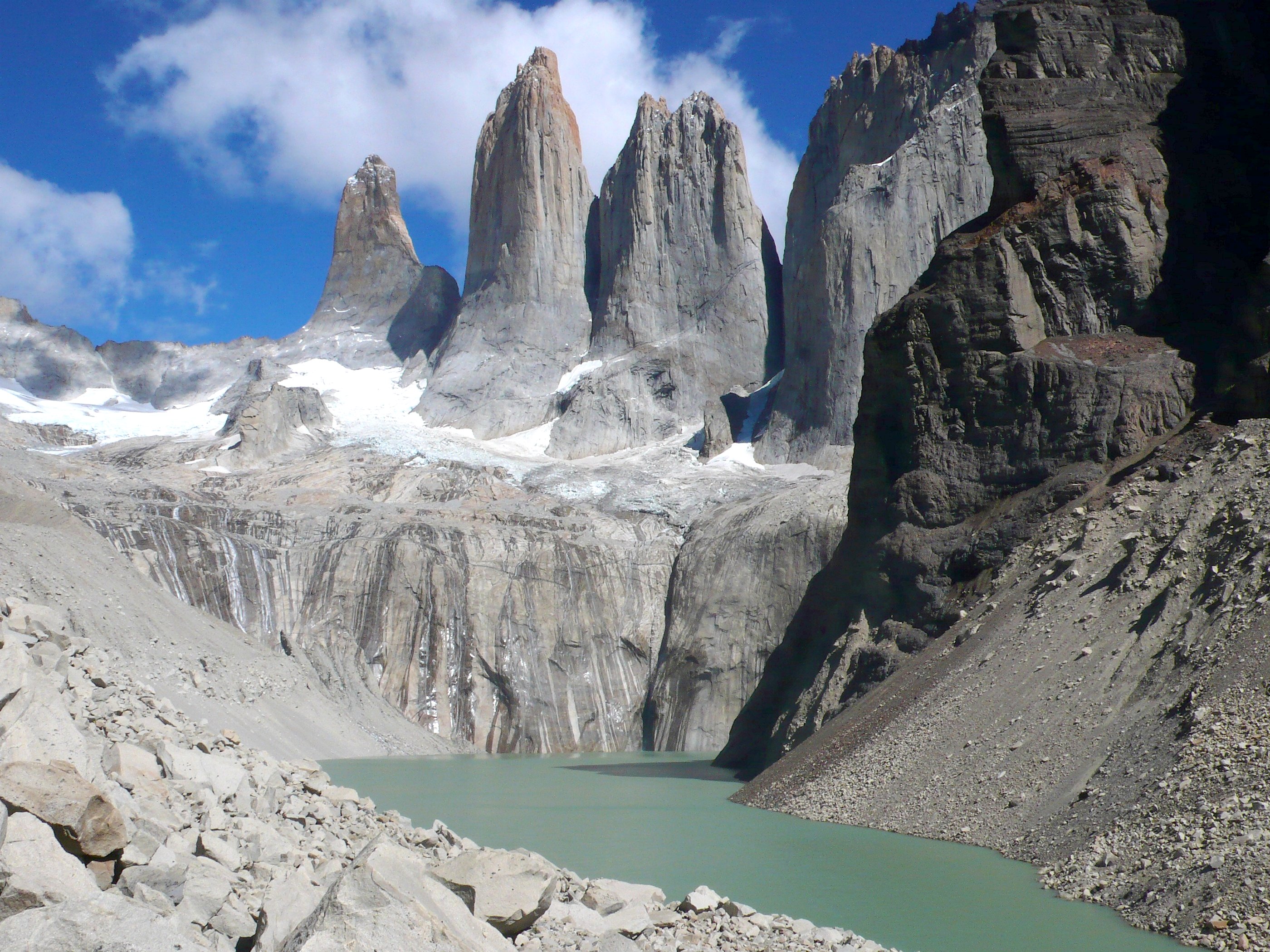
- Mirador Base Torres
- Puerto Pudeto
- Sector Paine Grande
- Mirador Francés
- Mirador Británico
- Mirador Salto Grande
- Mirador Glaciar Grey
- El Calafate
- El Chaltén
- Mirador Cerro del Torre
- Laguna de los Tres
- Lago del Desierto
- Huemul Hanging Glacier viewpoint
- Perito Moreno Glacier
01Puerto Natales+
Days 1–2 & 10 · Arrival and return flight.
02Lago Tyndall+
Days 2–4 · Accommodation base (approximate area).
03Mirador Base Torres+
Day 3 · Hike approximately 10.5 km from Centro de Bienvenida to Mirador Base Torres, then return along the same trail: 21.0 km round trip (about 13 miles).
Mirador Base Torres · round trip
- Distance
- 21.0 km
- Start
- 90 m
- Finish
- 90 m
Scroll the chart sideways to see the full route.
- Centro de Bienvenida0.0 km · 90 m
- Refugio Chileno · outbound3.5 km · 460 m
- Chileno descent5.0 km · 390 m
- Lenga forest · start of moraine climb8.5 km · 600 m
- Mirador Base Torres · turnaround10.5 km · 870 m
- Return through the lenga forest12.5 km · 600 m
- Return through the Ascencio Valley16.0 km · 390 m
- Refugio Chileno · return17.5 km · 460 m
- Centro de Bienvenida · finish21.0 km · 90 m
Approximate elevations and landmark distances, based on the supplied route profile. The line connects reference points; small terrain changes are not shown. Approximately 10.5 km each way, 21.0 km in total. Cross the Ascencio Valley, pass Refugio Chileno and the lenga forest, then climb the glacial moraine to the viewpoint at approximately 870 m before returning along the same trail.
04Mirador Británico+
Day 4 · Hike approximately 21.5 km from Centro de Bienvenida to Mirador Británico via Los Cuernos, Camp Italiano, and Mirador Francés. Continue 15.0 km via Camp Italiano and Lake Skottsberg to Guardería Pehoe: 36.5 km total (about 22.7 miles).
Centro de Bienvenida to Guardería Pehoe via Mirador Británico
- Distance
- 36.5 km
- Start
- 90 m
- Finish
- 45 m
Scroll the chart sideways to see the full route.
- Centro de Bienvenida0.0 km · 90 m
- Rolling lakeside trail5.0 km · 160 m
- Lakeside descent8.0 km · 120 m
- Los Cuernos11.5 km · 90 m
- Camp Italiano · outbound16.5 km · 230 m
- Mirador Francés19.0 km · 550 m
- Mirador Británico21.5 km · 850 m
- Camp Italiano · return26.5 km · 230 m
- Lake Skottsberg31.0 km · 80 m
- Final lakeside stretch34.0 km · 90 m
- Guardería Pehoe36.5 km · 45 m
Approximate elevations and landmark distances, based on the supplied route profile. The line connects reference points; small terrain changes are not shown. Approximately 36.5 km in total: 21.5 km to Mirador Británico, then 15.0 km to Guardería Pehoe via Camp Italiano and Lake Skottsberg. The route finishes at a different location from its starting point.
05Mirador Salto Grande+
Day 4 · Stop after the return ferry.
06Mirador Glaciar Grey+
Day 5 · Hike from Guardería Pehoé to Mirador Glaciar Grey and return: approximately 12.0 km each way, 24.0 km round trip (about 14.9 miles).
Mirador Glaciar Grey · round trip
- Distance
- 24.0 km
- Start
- 47 m
- Finish
- 47 m
Scroll the chart sideways to see the full route.
- Guardería Pehoé0.0 km · 47 m
- Outbound ridge approach3.5 km · 210 m
- Outbound high point5.5 km · 265 m
- Descent toward Grey8.0 km · 170 m
- Low point before the viewpoint10.5 km · 60 m
- Mirador Glaciar Grey · turnaround12.0 km · 75 m
- Return low point13.5 km · 60 m
- Return ridge approach16.0 km · 170 m
- Return high point18.5 km · 265 m
- Final ridge descent20.5 km · 210 m
- Return toward Pehoé22.0 km · 110 m
- Guardería Pehoé · finish24.0 km · 47 m
Approximate elevations and landmark distances, based on the supplied route profile. The line connects reference points; small terrain changes are not shown. Approximately 12.0 km each way, 24.0 km in total. Cross the ridge to Mirador Glaciar Grey, then return to Guardería Pehoé along the same trail.
07El Chaltén+
Days 6–7 · Overnight base and hiking departures.
08Mirador Cerro del Torre+
Day 6 · Hike from El Chaltén past Cascada Margarita and Mirador Cerro Torre to Laguna Torre, then return: approximately 18.5 km round trip (about 11.5 miles). The viewpoint is approximately 3.0 km from the start.
Mirador Cerro del Torre & Laguna Torre · round trip
- Distance
- 18.5 km
- Start
- 425 m
- Finish
- 425 m
Scroll the chart sideways to see the full route.
- El Chaltén0.0 km · 425 m
- Cascada Margarita · outbound1.5 km · 525 m
- Mirador Cerro Torre · outbound3.0 km · 625 m
- Rolling trail toward Laguna Torre6.0 km · 635 m
- Laguna Torre · turnaround9.25 km · 640 m
- Return through the valley12.5 km · 635 m
- Mirador Cerro Torre · return15.5 km · 625 m
- Cascada Margarita · return17.0 km · 525 m
- El Chaltén · finish18.5 km · 425 m
Approximate elevations and landmark distances, based on the supplied route profile. The line connects reference points; small terrain changes are not shown. This supplied profile continues beyond Mirador Cerro Torre to Laguna Torre near Campamento Agostini before returning to El Chaltén: approximately 18.5 km total. The viewpoint is approximately 3.0 km from the start; the lagoon is approximately 9.25 km from the start.
09Laguna de los Tres+
Day 7 · Hike from El Chaltén to Laguna de los Tres and return: approximately 10.5 km each way, 21.0 km round trip (about 13 miles).
Laguna de los Tres · round trip
- Distance
- 21.0 km
- Start
- 410 m
- Finish
- 410 m
Scroll the chart sideways to see the full route.
- El Chaltén0.0 km · 410 m
- Mirador Fitz Roy3.0 km · 700 m
- Laguna Capri4.5 km · 720 m
- Campamento Poincenot · outbound8.8 km · 760 m
- Laguna de los Tres · turnaround10.5 km · 1180 m
- Descent from the lagoon12.0 km · 760 m
- Return through the valley15.0 km · 710 m
- Final descent begins18.0 km · 700 m
- El Chaltén · finish21.0 km · 410 m
Approximate elevations and landmark distances, based on the supplied route profile. The line connects reference points; small terrain changes are not shown. Approximately 10.5 km each way, 21.0 km in total. Pass Mirador Fitz Roy, Laguna Capri, and Campamento Poincenot before the steep climb to Laguna de los Tres, then return to El Chaltén.
10Huemul Hanging Glacier viewpoint+
Day 8 · Hike from the Lago del Desierto trailhead to the glacial lagoon below Huemul Hanging Glacier and return: approximately 1.65 km each way, 3.3 km round trip (about 2.1 miles).
Huemul Hanging Glacier · round trip
- Distance
- 3.3 km
- Start
- 510 m
- Finish
- 510 m
Scroll the chart sideways to see the full route.
- Lago del Desierto trailhead0.0 km · 510 m
- Gentle forest walk0.7 km · 540 m
- Steep mud and roots climb1.2 km · 620 m
- Approach to the lagoon1.5 km · 720 m
- Huemul glacial lagoon · turnaround1.65 km · 725 m
- Start of return descent1.8 km · 720 m
- Return down the steep section2.2 km · 620 m
- Return through the forest2.6 km · 540 m
- Lago del Desierto trailhead · finish3.3 km · 510 m
Approximate elevations and landmark distances, based on the supplied route profile. The line connects reference points; small terrain changes are not shown. Approximately 1.65 km each way, 3.3 km in total. A gentle forest walk leads to a steep section of mud and roots, then the glacial lagoon below Huemul Hanging Glacier. Return along the same trail.
11Perito Moreno Glacier+
Day 9 · Glacier excursion from El Calafate.
DAY BY DAY
Your Patagonia itinerary.
Day 1Fly to Puerto Natales+
Fly to Puerto Natales (PNT).
Day 2Puerto Natales → Lago Tyndall+
Arrive in Puerto Natales (PNT), rent a car, and drive to Lago Tyndall, south of Torres del Paine, Chile.
Day 3Mirador Base Torres+
Drive to the Centro de Bienvenida, enter the park, and hike approximately 10.5 km to Mirador Base Torres via the Ascencio Valley, Refugio Chileno, lenga forest, and the final glacial moraine climb. Eat lunch and hike approximately 10.5 km back to the Centro (21.0 km round trip, about 13 miles). Drive back to Lago Tyndall for dinner.
Day 4Mirador Francés & Mirador Británico+
Drive to Centro de Bienvenida and hike via Los Cuernos and Camp Italiano to Mirador Francés (approximately 19.0 km from the start), then continue to Mirador Británico (21.5 km from the start). Descend via Camp Italiano and pass Lake Skottsberg to finish at Guardería Pehoe, another 15.0 km from Mirador Británico. Total walking distance: approximately 36.5 km (about 22.7 miles). Take the catamaran back to Puerto Pudeto and stop at Mirador Salto Grande. Drive back to Lago Tyndall for dinner.
Day 5Mirador Glaciar Grey → El Calafate+
Drive to Puerto Pudeto and take the 8:00 am catamaran to Sector Paine Grande. Hike approximately 12.0 km from Guardería Pehoé to Mirador Glaciar Grey, eat lunch, and return along the same trail (24.0 km round trip, about 14.9 miles). Take the catamaran back to Puerto Pudeto. Drive to El Calafate (4 hours) and stay in El Calafate.
Day 6El Chaltén & Mirador Cerro del Torre+
Drive to El Chaltén (2 hours from El Calafate) and hike past Cascada Margarita to Mirador Cerro Torre (approximately 3.0 km from the start), continuing to Laguna Torre near Campamento Agostini before returning to El Chaltén (approximately 18.5 km round trip, about 11.5 miles). Stay in El Chaltén.
Day 7Laguna de los Tres & Mount Fitz Roy+
Hike from El Chaltén via Mirador Fitz Roy, Laguna Capri, and Campamento Poincenot to Laguna de los Tres for views of Mount Fitz Roy (approximately 10.5 km each way, 21.0 km round trip, about 13 miles). Stay in El Chaltén.
Day 8Lago del Desierto & Huemul Hanging Glacier+
Drive to Lago del Desierto (1 hour) and hike to the glacial lagoon below Huemul Hanging Glacier (approximately 1.65 km each way, 3.3 km round trip, about 2.1 miles). Drive to El Calafate (3 hours) and stay in El Calafate.
Day 9Perito Moreno Glacier+
Drive to Perito Moreno Glacier (1 hour), take a glacier tour (4 hours), and return to El Calafate (1 hour). Stay in El Calafate.
Day 10Puerto Natales → United States+
Drive to Puerto Natales (4 hours from El Calafate) and fly back to the United States.
THOUGHTFULLY TAKEN CARE OF
More presence.
Fewer logistics.
- ✓ Private shuttle and luggage transportation
- ✓ Unique accommodations near hiking destinations
- ✓ Personally guided hiking excursions
- ✓ Insights into the region’s cultural, literary, and political history
Dates, availability, accommodation details, and the final itinerary are confirmed personally before booking.
YOUR NEXT CHAPTER
Every great journey
starts with a conversation.
Tell Keri and Ryan where you’d like to go. We’ll help you find the right journey—or shape one around you.
KEEP EXPLORING